¶ FW-ORT-01-01 – Photography Locations at a Glance
This overview provides access to photography locations for landscape, nature, wildlife and travel photography. The present focus is Germany: from the Fichtel Mountains and Franconian Switzerland to the Sababurg primeval forest, Müritz National Park, Rügen and Zingst, as well as selected observation areas for common cranes and European bee-eaters. A separate Europe overview prepares the later international expansion.
Every location page should do more than list subjects. It should make light, season, access, protection status, coordinate type and responsible behaviour understandable.
Language note: This is the English version. Open the German photography-locations overview for the original German page. Detail pages that have not yet been translated are linked explicitly to the German locale.
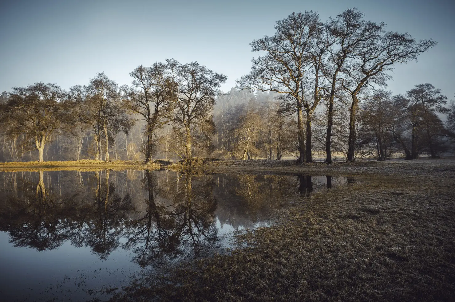
Eger River in the Fichtel Mountains near Selb. Original photograph: Stefan Strößenreuther. Open the photograph at full size.
¶ Document Information
| Document information | Definition |
|---|---|
| Document ID | FW-ORT-01-01 |
| Title | Photography Locations at a Glance |
| Section | Photography locations |
| Page type | Public SEO, navigation and planning page |
| Responsible | Wiki owner |
| Version | 2.0 EN |
| Translation basis | German version 2.0 |
| Last reviewed | 4 August 2026 |
| Document status | Public – editorially reviewed |
| Classification | Public |
| Scope | Published location, regional, protected-area and wildlife-photography pages in the Photographer Wiki |
| Data basis | Local page and link inventory plus official information from BfN, the German Commission for UNESCO and National Natural Landscapes |
| Last source and link review | 4 August 2026 |
| Next review | 4 November 2026 or when new location pages, access rules or protection requirements change |
| Wiki.js path | /Fotografen-Wiki/Fotoorte/FW-ORT-01-01_Uebersicht_Fotoorte |
¶ Review Traffic Light
| Review area | Status | Result |
|---|---|---|
| Photography-location page inventory | 🟢 Green | Published location, regional, protected-area and wildlife-photography pages compared with the local inventory |
| Interactive location finder | 🟢 Green | Seventeen existing target pages linked with region, type, subject and recommended season |
| Outdated planning entries | 🟢 Green | Europe and FW-ORT-FS-04 removed from the planned list and included as existing pages |
| Internal Wiki links | 🟢 Green | Unique locale and path targets checked against the page export on 4 August 2026 |
| Header image and infographic | 🟢 Green | Original Eger photograph retained; new English SVG planning infographic checked and made enlargeable |
| Coordinates | 🟠 Orange | A coordinate may indicate an area centre, car park, viewpoint or starting point and must be checked again before the tour |
| Access and protection rules | 🟠 Orange | Closures, path requirements, breeding periods, opening hours and ownership can change at short notice |
| Wildlife locations | 🟠 Orange | Sensitive breeding, roosting and staging sites are not published with uncontrolled precise coordinates |
| Travel and safety conditions | 🟠 Orange | Weather, forestry work, traffic, mobile coverage and rescue access require a same-day check |
| Public sources | 🟢 Green | BfN, UNESCO and National Natural Landscapes sources reviewed on 4 August 2026 |
Overall status Orange: The Wiki structure, internal links and image paths are checked. A location page is nevertheless not a permanent access permit. Current information from the responsible authority, signs on site, weather and safety conditions, and the protection of wildlife and habitats always take precedence.
¶ SEO Data
| SEO field | Content |
|---|---|
| Focus keyword | photography locations |
| Additional keywords | photography locations Germany, photo spots Germany, landscape photography locations, nature photography, wildlife photography |
| Search intent | Find suitable photography locations by region, subject and season and plan them responsibly |
| Meta title | Photography Locations – Germany, Regions and Photo Spots |
| Meta description | Discover locations for landscape, nature and wildlife photography: Fichtel Mountains, Franconian Switzerland, Rügen, Zingst, protected areas and planning guidance. |
¶ 1. Quick Access
| Subject | Suitable starting point |
|---|---|
| Map and coordinates | Interactive map of selected photography locations – German |
| Protected areas in general | Protected areas in Germany – German |
| National parks | National parks in Germany – German |
| Nature parks | Nature parks in Germany – German |
| Biosphere reserves | Biosphere reserves in Germany – German |
| Rocks and uplands | Fichtel Mountains – German and Franconian Switzerland – German |
| Coast and Baltic Sea | Photo hotspots on Rügen – German and Max Hünten House in Zingst |
| Common cranes | Common crane hotspots in Germany – German |
| European bee-eaters | European bee-eaters in Germany – German |
| Europe | Photography locations in Europe – German |
¶ 2. Interactive Photography-Location Finder
Search and filters can be combined. The season indicates the typical principal photographic window, not the only worthwhile travel period. The linked detail pages provide a more precise assessment.
17 of 17 locations
| Region | Type | Subjects | Season | Detail page | |
|---|---|---|---|---|---|
| Fichtel Mountains | Bavaria | Region | granite, forest, summits, Eger | year-round | Open German page |
| Franconian Switzerland | Bavaria | Region | limestone, caves, valleys, castles | year-round | Open German page |
| Rocks and viewpoints | Bavaria | Location | limestone, views, side light | autumn | Open German page |
| Castles and ruins | Bavaria | Location | architecture, history, landscape | year-round | Open German page |
| Valleys, rivers and forests | Bavaria | Location | streams, forest, mist | autumn | Open German page |
| Sababurg primeval forest | Hesse | Location | old trees, deadwood, ferns, mist | autumn | Open German page |
| Müritz National Park | Mecklenburg-Western Pomerania | National park | lakes, moorland, forest, cranes | autumn | Open German page |
| Rügen | Mecklenburg-Western Pomerania | Region | chalk coast, Cape Arkona, seaside resorts | year-round | Open German page |
| Max Hünten House, Zingst | Mecklenburg-Western Pomerania | Photographic infrastructure | base, exhibitions, photo tours | year-round | Open English page |
| Common crane hotspots | Across Germany | Wildlife photography | staging, fly-in, observation | autumn | Open German page |
| KRANORAMA and KRANICHWELTEN Günz | Mecklenburg-Western Pomerania | Wildlife observation | cranes, observation, information | autumn | Open German page |
| European bee-eaters in Germany | Across Germany | Wildlife photography | flight, perch, colony environment | summer | Open German page |
| National parks in Germany | Across Germany | Protected areas | wilderness, coast, forest, mountains | year-round | Open German page |
| Nature parks in Germany | Across Germany | Protected areas | natural and cultural landscapes | year-round | Open German page |
| Biosphere reserves in Germany | Across Germany | Protected areas | natural and cultural landscapes | year-round | Open German page |
| UNESCO beech forests | Across Germany | Protected areas | old beech forests, woodland structures | autumn | Open German page |
| Photography locations in Europe | Europe | Overview | regions, countries, future expansion | year-round | Open German page |
| No location matches the current filter combination. | |||||
Technical requirement: Search, filters and sorting use the centrally installed Filterable Comparison Tables component. Without JavaScript, all seventeen entries and links remain visible.
Not a ranking: The finder does not rate beauty or photographic quality. It leads to existing detail pages by region, page type and typical season.
¶ 3. Understanding Protected Areas
National parks, nature parks, biosphere reserves, nature reserves and Natura 2000 sites pursue different protection objectives. Categories can overlap geographically. The name alone therefore does not indicate whether paths, tripods, night photography, events or commercial productions are permitted.
| Page | Photographic focus | Planning benefit |
|---|---|---|
| Protected areas in Germany – German | Categories, overlaps and basic terminology | Classify protection status before the tour |
| National parks in Germany – German | Large natural landscapes and natural dynamics | Select a landscape type and national park |
| Nature parks in Germany – German | Natural and cultural landscapes | Regional travel and landscape planning |
| Biosphere reserves in Germany – German | Model regions and cultural landscapes | Connect landscape, habitats and sustainable use |
| UNESCO beech forests – German | Old forests and woodland structures | Compare locations and light conditions |
Important: Protected-area figures must not simply be added to derive one total area. Germany's Federal Agency for Nature Conservation explicitly notes that categories can overlap.
¶ 4. Regions and Photographic Subjects
¶ Bavaria
- Fichtel Mountains: granite formations, forests, summits, viewpoints and the Eger floodplain.
- Franconian Switzerland: limestone rocks, caves, viewpoints, castles, ruins, valleys, rivers and forests.
- Project Fränkische: suitable for long-term black-and-white series about rock, forest and cave landscapes.
¶ Hesse
- Sababurg primeval forest: old trees, deadwood, ferns and graphic woodland structures; especially effective in diffuse light, mist and autumn colour.
¶ Mecklenburg-Western Pomerania
- Müritz National Park: lakes, moorland, beech forest, waterbirds and common cranes.
- Rügen: chalk coast, Cape Arkona, seaside resorts, piers and coastal light.
- Zingst and Darß: base for coast, forest and crane tours; the Max Hünten House serves as a photographic point of contact.
¶ Europe
The Europe overview – German already exists. Individual European regions will be added only after reliable research, personal experience or clearly identified sources.
¶ 5. Wildlife Photography: Behaviour Before Location
In wildlife photography, animal welfare takes precedence over obtaining an image. Breeding sites, roosts and sensitive gathering areas are not made public through uncontrolled precise location data. Official observation facilities, authorised paths and adequate distance should be preferred.
| Subject | Further page |
|---|---|
| Common crane migration and staging regions | Common crane hotspots in Germany – German |
| Body language and warning signals | Understanding and photographing common crane behaviour – German |
| Observation facility near Günz | KRANORAMA and KRANICHWELTEN – German |
| European bee-eaters | Photographing European bee-eaters in Germany – German |
¶ 6. Selecting Locations by Season
| Season | Typical subjects | Planning note |
|---|---|---|
| Spring | Fresh foliage, blossom, flowing water and increasing wildlife activity | Check breeding periods, path requirements and seasonal closures |
| Summer | Long days, rocks, forests, European bee-eaters and travel photography | Allow for hard midday light, heat and visitor numbers |
| Autumn | Woodland colour, mist, common crane migration and wet rock | Start early and observe protection distances and weather protection |
| Winter | Hoar frost, snow, simplified woodland structures and rock details | Account for short days, ice, cold and restricted paths |
The best time of day follows the subject: low side light models rocks and trees, overcast conditions reduce woodland contrast, mist separates layers, and backlight emphasises leaves, grasses or haze.
¶ 7. From Subject to Photo Tour
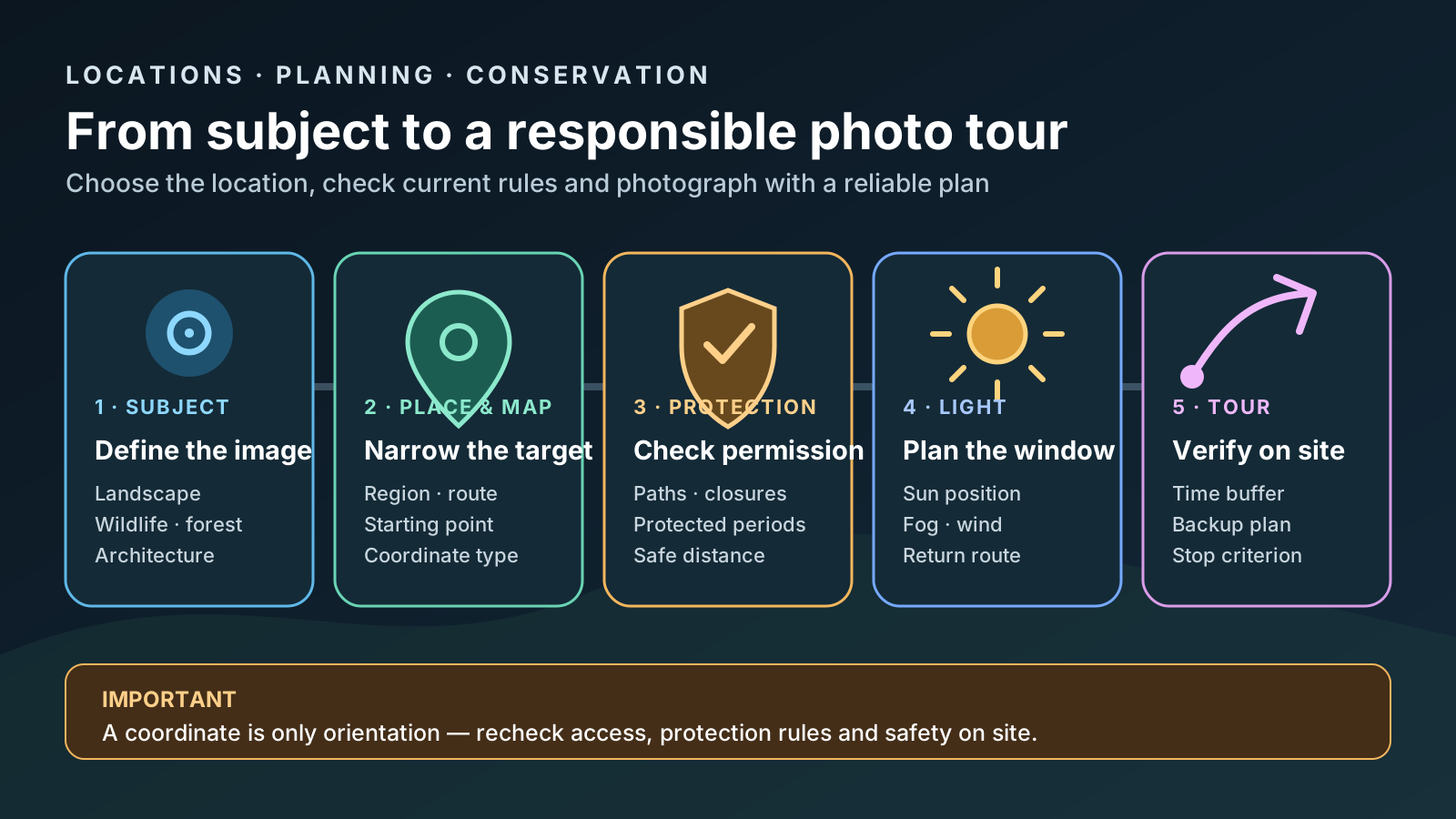
Original editorial infographic. Open the planning workflow at full size.
Before departure, clarify at least:
- image idea and alternative subject,
- exact meaning of each coordinate,
- current access rules and opening hours,
- path requirements, seasonal closures and protected periods,
- weather, precipitation, wind and visibility,
- sun or moon position and terrain,
- parking, public transport and permitted starting point,
- distance, elevation, surface and return route,
- mobile coverage, offline map and emergency information,
- focal lengths, tripod, batteries and weather protection.
Stopping is part of the plan: Dangerous weather, stressed wildlife, closed paths, an unclear return route or missing equipment are reasons to postpone the photograph.
¶ 8. Using Maps and Coordinates Correctly
The interactive photography-location map – German combines selected coordinates that can responsibly be made public. Every coordinate needs a clear type:
| Coordinate type | Meaning |
|---|---|
| Area centre | Broad geographic orientation, not a camera position |
| Visitor centre | Official information and possible tour start |
| Car park or stop | Travel reference; access and availability require a current check |
| Viewpoint | Publicly known location; verify access and opening hours |
| Observation facility | Authorised wildlife observation; follow rules and opening times |
| Tour start | Beginning of a route; makes no statement about the status of the remainder of the route |
Precise coordinates are not published for sensitive wildlife locations, protected plants, unsecured caves or habitats vulnerable to disturbance.
¶ 9. Responsible Nature Photography
- Remain on marked and authorised paths.
- Respect barriers and temporary closures.
- Do not pursue, bait or surround wildlife.
- Do not alter plants, deadwood or rocks for a photograph.
- Position tripods so that paths and habitats remain unobstructed.
- Use drones only where conservation, aviation, property and local rules permit them.
- Do not distribute location data for sensitive species without control.
- Take all litter away and keep groups as small as possible.
Further pages:
- Behaviour in protected areas – German
- Cave protection and cave safety – German
- Drone photography – German
¶ 10. Planned Structural Pages
| Document ID | Planned page | Purpose |
|---|---|---|
| FW-ORT-DE-01 | Germany overview | Navigation by federal states and landscape regions |
| FW-ORT-BY-01 | Bavaria overview | Combine regions and photography locations within Bavaria |
| FW-HOE-FS-01 | Caves overview | Structure public, restricted and protected cave subjects |
| FW-ORT-WELT-01 | Worldwide photography locations | Long-term international structure after reliable research |
Europe and FW-ORT-FS-04 are no longer planning entries; both pages already exist and are linked above.
¶ 11. Frequently Asked Questions
¶ Does Every Location Page Include Exact Coordinates?
No. Coordinates are included only when they are useful for orientation and justifiable for protection and safety reasons. Information is deliberately generalised for sensitive species and dangerous locations.
¶ Are the Locations Accessible at All Times?
No. Seasonal closures, conservation measures, weather, forestry work, events and private ownership can change access.
¶ Which Camera Suits These Locations?
Wide-angle to short telephoto focal lengths are often sufficient for landscape and travel photography. Wildlife photography requires longer working distances and usually longer focal lengths. In woodland, low light and long exposures, a tripod can be useful where it can be deployed safely and is permitted.
¶ Can Photographs from Protected Areas Be Published?
Taking and publishing an image must be assessed separately. Protected-area rules, personality rights, property rights and possible commercial use require an individual review.
¶ 12. Related Wiki Pages
- Photographer Wiki homepage
- Photography equipment overview
- Landscape photography – German
- Travel photography – German
- Natural light – German
- Golden and blue hour – German
- Page register – German
¶ 13. Sources and Review Basis
| Source | Use |
|---|---|
| Federal Agency for Nature Conservation – protected areas | Categories, overlaps and map application |
| Federal Agency for Nature Conservation – nature parks in Germany | Nature-park definition and nationwide data |
| German Commission for UNESCO – biosphere reserves in Germany | UNESCO biosphere reserves and model regions |
| National Natural Landscapes | Common entry point for national parks, nature parks, biosphere reserves and wilderness areas |
| Local Wiki inventory dated 4 August 2026 | Target pages, paths, image uses and technical filter entries |
Source principle: For a specific tour, the current website of the responsible authority, official notices and signs on site take precedence. A Wiki page does not replace permission to enter.
¶ 14. Revision History
| Version | Date | Change |
|---|---|---|
| 1.0 EN | 28 July 2026 | Created public English SEO overview with protected areas, regions, wildlife photography, subject and seasonal selection, tour planning, coordinate rules and conservation |
| 1.1 EN | 28 July 2026 | Linked the practical landscape-photography page |
| 2.0 EN | 4 August 2026 | Synchronized with German version 2.0; added current metadata, ten-row vertical review traffic light, enlargeable original photograph, English planning infographic, filterable finder with seventeen existing targets, updated regions, coordinate rules, warnings, official sources and full internal-link review |